《TAIPEI TIMES》 COA unveils two new aerial drones

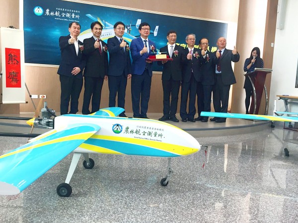
Officials pose next to uncrewed aerial vehicles at an unveiling ceremony at the Council of Agriculture in Taipei yesterday. Photo: CNA
’HAWK EAGLES’: The drones can reach an altitude of 4,000m and stay in the air for up to four hours, and are to boost the Forestry Bureau’s aerial survey efforts
By Lin Chia-nan / Staff reporter
The Council of Agriculture (COA) yesterday unveiled two new uncrewed aerial vehicles developed by a local firm to improve its aerial surveys and assist in quarantine measures against African swine fever.
The disease has spread to 23 provinces in China and pig carcasses have been found across Taiwan over the past weeks, but only one found in Kinmen County on Dec. 31 had tested positive for the disease as of yesterday.
The fixed-wing drones could be used to help the coast guard hunt for pig carcasses drifting at sea, in addition to surveying agricultural lands and crop production, COA Deputy Minister Lee Tui-chih (李退之) told a news conference in Taipei.
The nation’s pork products are safe and supplies are stable, he said, adding that the council would continue to protect the local hog industry against the disease.
The drones represent a leap in the Forestry Bureau’s aerial surveys, which would continue to develop while requiring fewer personnel and less funding, Forestry Bureau Director-General Lin Hwa-ching (林華慶) said.
The drones were named “Hawk Eagles” — the nation’s biggest raptor species — by bureau officials in the hope that they would capture images as swiftly and precisely as the birds, Lin said.
Established in 1954, the bureau’s Aerial Survey Office is tasked with taking aerial photographs for agricultural use, while judicial and other government agencies also refer to its images for investigation or land planning purposes, Lin said.
The office relies on images taken by satellites and crewed aircraft, while the drones can take pictures from lower altitudes, office Director Kuan Li-hao (管立豪) said, adding that it plans to purchase two more drones and another crewed aircraft.
The drones, which cost NT$14 million (US$454,368) each, have an operational ceiling of 4,000m and can stay airborne for up to four hours, said Lo Cheng-fang (羅正方), chairman of Geosat Aerospace and Technology Inc, which built the aircraft.
Nearly 90 percent of the drones’ components were locally produced, while their engines were made in Japan and their imaging devices were produced by Denmark’s Phase One, he said.
Geosat has entered the Malaysian and Indonesian markets and plans to enter other markets, Lo added.
新聞來源:TAIPEI TIMES


