《TAIPEI TIMES》 Rains to abate as super typhoon moves away
FESTIVE OUTLOOK: Temperatures are expected to rebound throughout the nation, with warm weather forecast for the Mid-Autumn Festival long weekend
By Shelley Shan / Staff reporter
Heavy rains brought by Super Typhoon Hinnamnor are forecast to further ease today as the storm moves away from Taiwan, while a southwesterly wind might bring rain to central and southern regions, the Central Weather Bureau said yesterday.
The bureau lifted a land alert for Hinnamnor at 11:30am yesterday and a sea alert at 8:30pm as the storm moved toward South Korea.
The typhoon was 440km northeast of Taipei as of 8:30pm. It had a radius of 300km and was moving northwest at 19kph, packing sustained winds of 184kph near its center, bureau data showed.
Although Hinnamnor’s center did not make landfall on Taiwan proper, its circumference brought substantial rainfall, relieving the nation from a potential water shortage caused by a lack of rain in July and last month.
The Water Resources Agency on Saturday estimated that 12,430 tonnes of water has been added to reservoirs across the country over the weekend.
The greater Taipei area would have sufficient water until the end of this year, as the water level at the Feitsui Reservoir (翡翠水庫) is expected to reach 88 percent of capacity from 57.42 percent before the typhoon, the reservoir administration said yesterday.
The rain and wind brought by Hinnamnor caused power outages in more than 23,000 households nationwide, and disrupted air, land and sea transportation services, Central Emergency Response Center data showed on Saturday.
Taoyuan and New Taipei City, as well as Hsinchu and Yilan counties, have evacuated 943 people as a precaution due to mudflow alerts, the center said.
No casualties had been reported as of press time last night.
Temperatures are forecast to rebound nationwide today, with a high of 34°C, the bureau said.
Isolated showers are forecast for central and southern Taiwan due to the southwesterly wind, it said.
Cloudy to sunny skies are forecast for northern and eastern regions, with isolated thundershowers forecast in the afternoon, it said.
From Wednesday to Saturday, isolated showers are forecast over the east coast, with cloudy to sunny skies forecast for the rest of the nation, the bureau said.
Chances of afternoon thundershowers are high in central and southern Taiwan as well as mountainous areas nationwide, it said.
The average high temperature would reach 31°C to 32°C in the north and 33°C to 34°C in central and southern regions, it said.
The bureau said that a tropical disturbance could occur in the northwest Pacific this week, although more observations are necessary to make a better assessment.
Northeasterly winds would be the predominant influence on the weather from Thursday until the Mid-Autumn Festival long weekend, which is to begin on Friday, WeatherRisk analyst Wu Sheng-yu (吳聖宇) said yesterday.
“From the data we collected so far, daytime temperatures are likely to be high during the long weekend, while the weather would be slightly cool at night and in the early morning,” Wu said.
新聞來源:TAIPEI TIMES

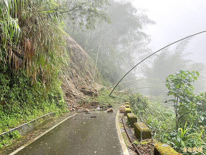
A mountain road in Chiayi County yesterday is blocked by the debris of a rockslide triggered by Typhoon Hinnamnor. Photo: Lin Yi-chang, the Liberty Times


