離開
離開 進入
進入《TAIPEI TIMES》 Typhoon rocks Saipan; might pass Taiwan by
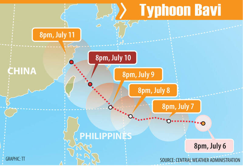
Typhoon Bavi is forecast to pass north of Taiwan.
/ Staff writer, with CNA and AFP
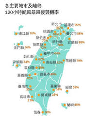
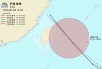
Typhoon Bavi’s center is looking more likely to pass north of Taiwan than to make landfall in the northern part of the country, the Central Weather Administration (CWA) said yesterday, adding that the storm is still too far away to forecast its exact track.
As of 2pm yesterday, the center of Typhoon Bavi was about 2,560km east-southeast of Taiwan, moving west-northwest at 27kph, according to the agency.
The storm, which has a radius of 350km, had sustained winds of 216kph near its center, with gusts of up to 270kph, CWA data showed.
Bavi is expected to pass closest to Taiwan on Friday or Saturday, the agency said, adding that, based on current data, it could issue a sea warning for the storm as early as Thursday, and a land warning late on Thursday or early on Friday.
Independent meteorologist Daniel Wu (吳德榮) yesterday said that Bavi, classified by the agency as an “intense typhoon,” has developed into a large and powerful storm, a phenomenon typically associated with El Nino conditions.
As a safety precaution with powerful Bavi approaching the area, ferry services between Taiwan proper and Green Island (綠島) and Orchid Island (Lanyu, 蘭嶼) southeast of Taiwan would be suspended from noon tomorrow.
Authorities in the Northern Marianas and Guam reported extensive damage including fallen trees and downed power lines yesterday after Typhoon Bavi swept through.
No casualties had been reported as of early evening, although with treacherous conditions throughout much of the day hindering cleanup operations, a full picture was yet to emerge. Worst hit was the small island of Rota, hit by the full force of the typhoon early yesterday with winds of up to 290kph, knocking out power, water and communications for many of its 1,500 people.
Rota Municipal Operations Center spokesperson Lou Rosario, said that there had been reports of “major” damages.
“A lot of telephone and power lines down. I think this is a major, major storm,” Rota Chamber of Commerce president Juan Pan Guerrero said.
The US National Weather Service (NWS) had said that a direct hit by Bavi would make most of Rota “uninhabitable for weeks, perhaps longer.”
The island of Tinian, northern parts of Guam and the southern tip of Saipan were all savaged by typhoon winds. On Guam, witnesses reported downed trees, fallen streetlamps, debris strewn over roads and at least one car flipped over by the wind.
About 10 major roads were impassable due to flooding, fallen trees, downed utility lines, rockslides and other storm-related damage, Guam authorities said.
“Stay off the road. Any additional vehicles on the road hinders emergency responders and delays the expedited clearing of the roads,” the Guam Joint Information Center said, saying that “hazardous conditions remain.”
Edwin Santa Theresa, a 56-year-old health worker on Tinian island said that residents had been “prepared” for the storm after being hit by Super Typhoon Sinlaku in April.
“Our power was only restored to my house four days ago [after Sinlaku], but now it’s out again. I just hope that after this typhoon passes, electricity will be restored quickly,” he said.
Rowell Mariano, a Saipan resident, said that the April storm was worse for him.
“Sinlaku was stronger because the center of the storm passed directly over Saipan,” Mariano said. “During Sinlaku, our house was flooded because of the strong winds and heavy rain, and our ceiling was damaged. Sinlaku was really traumatic for us.”
In 2023, Guam and the Northern Marianas were hit by Mawar, the biggest storm in decades.
Warmer oceans help tropical storms to intensify and add more moisture, which can fall as heavy rain.
The world’s oceans experienced their hottest June on record and could set new records in the months ahead, the EU’s Copernicus Marine Service said last week.
The World Meteorological on Friday said that El Nino, which typically occurs every two to seven years and lasts nine to 12 months, has already begun in the tropical Pacific and is likely to be strong.
The natural climate phenomenon warms surface temperatures in the central and eastern equatorial Pacific Ocean, bringing worldwide changes in winds, pressure and rainfall patterns.
“Our big concern for this being an El Nino year is that it’s going to be a lot busier than we’ve seen in the last five or six years,” NWS meteorologist Marcus Landon Aydlett said.
新聞來源:TAIPEI TIMES
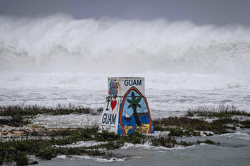
High waves crash against the coastline at a beach as the forecasted Super Typhoon Bavi approaches in Guam on Sunday. Photo: AFP